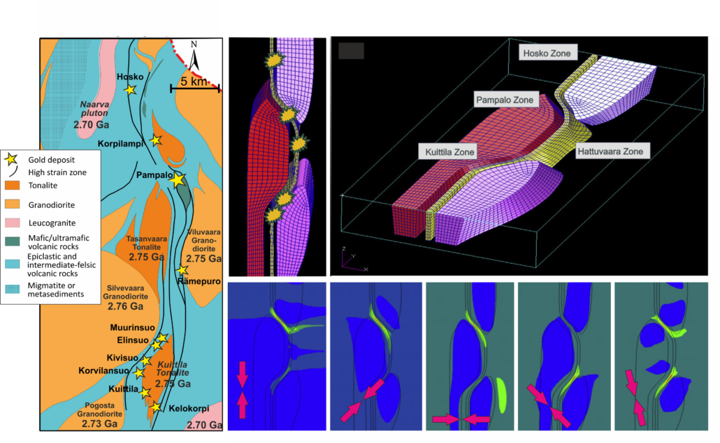
Modelling of the location of dilatational zones in the Hattu schist belt. Red arrows: orientation of stress field; bright green and red fields: dilatation zones.
The model for the Hattu schist belt indicates that the dilatational zones with occurrences of gold deposits most likely developed under NNW-SSE oriented compressional stressfield. Undiscovered deposit(s) may exist northeast of the Pampalo mine.
(Last update: 20.05.2020)
Structurally enhanced permeability in high strain zones is a critical factor in the formation of orogenic gold deposits.
Development of dilatational zones capable to focus fluid flow is driven by the spatial relationships between the structural architecture, the orientation of contacts among rock units with competency differences, the fluid pressure, and the orientation of far-field stresses. These properties can be taken into account in numerical modeling for prediction of dilatational zones at various scales and under various stress field orientation.
On the belt/district scale the validity of the model is justified by the relationships between the predicted dilatational zones and location of known deposits. The model may also indicate previously unrecognized dilatational/fluid flow zones and support recognition of new targets for mineral exploration.